

Home  /  News  /  QSO via SR7KI Łysa Góra

News · 18 September 2026

From Stary Mokotów to Łysa Góra

An antenna on a tenement chimney in Stary Mokotów, an Icom IC-9700 at home, and on the other side the repeater SR7KI on the RTCN Święty Krzyż tower, 149.8 km to the south. There is no line of sight between us, and 25 km of the path lies beyond the horizon of both antennas. And yet I can get into the Łysa Góra repeater.

Filip SQ5CBA — portrait
Filip SQ5CBAQSO · QTH Stary Mokotów
Icom IC-9700
Icom IC-9700radio used for this QSO · up to 75 W
70 cm · narrow FM SR7KI Łysa Góra 149.8 km IC-9700 + X-200N
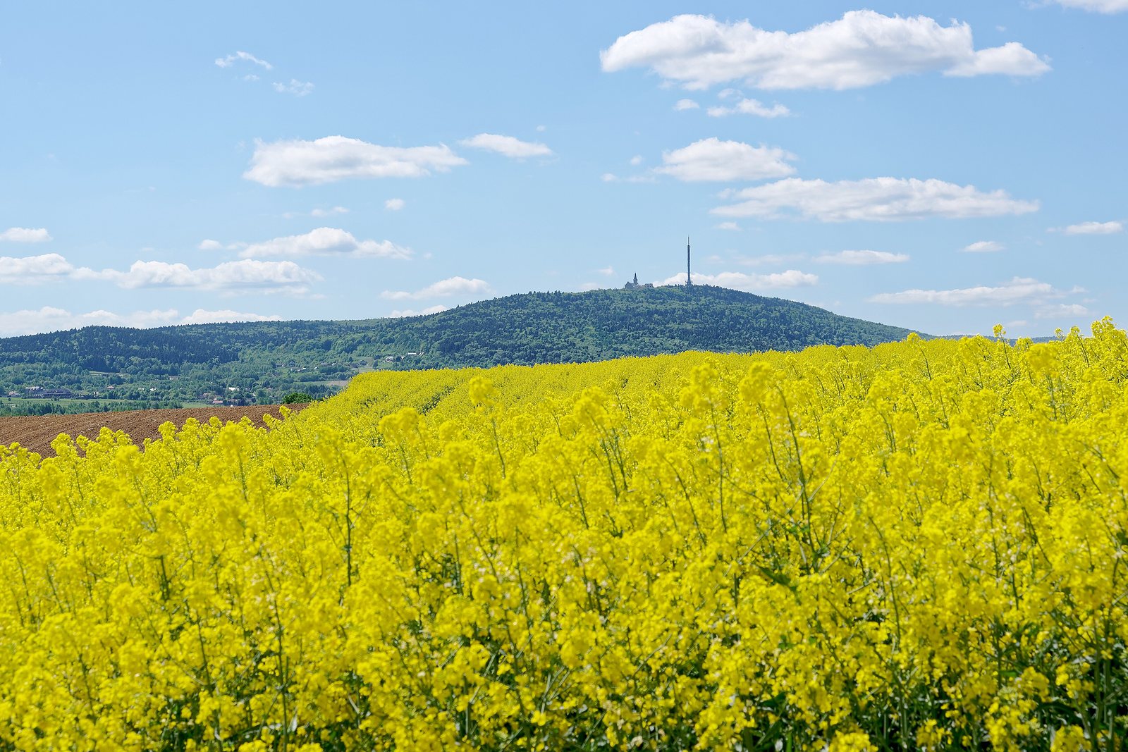
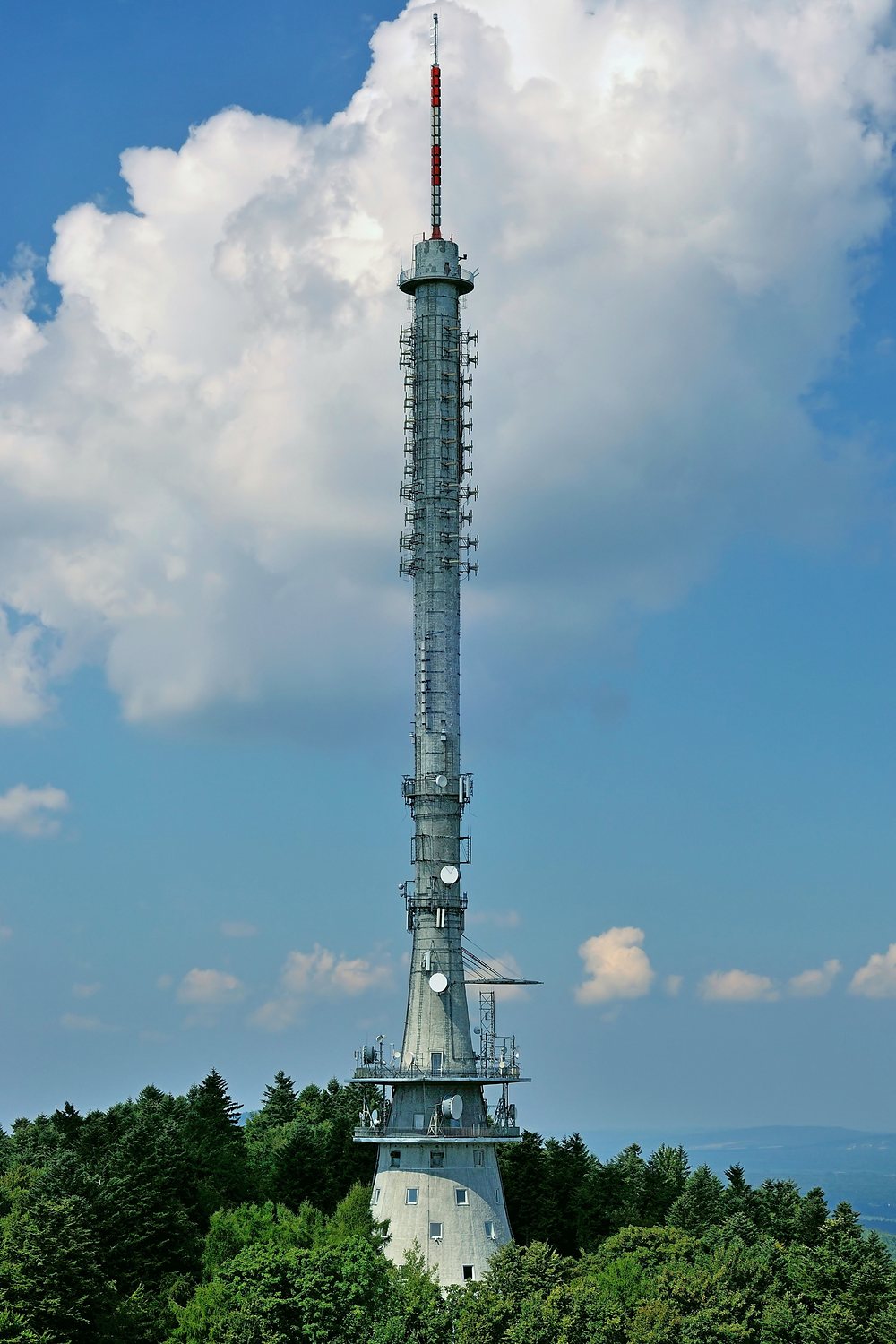
RTCN Święty Krzyż · photo: Kroton, CC BY 3.0
149.8km in a straight line
from the roof to the tower
713m a.s.l., SR7KI antenna
terrain 593 m + 120 m tower
25km of the path beyond the horizon
of both antennas
438.725MHz, SR7KI output
listen here
QSO

A tenement, a chimney and a holy mountain

No beam and no amplifier. A vertical on the chimney, the radio at home and a repeater 150 km away.

From a roof in Stary Mokotów

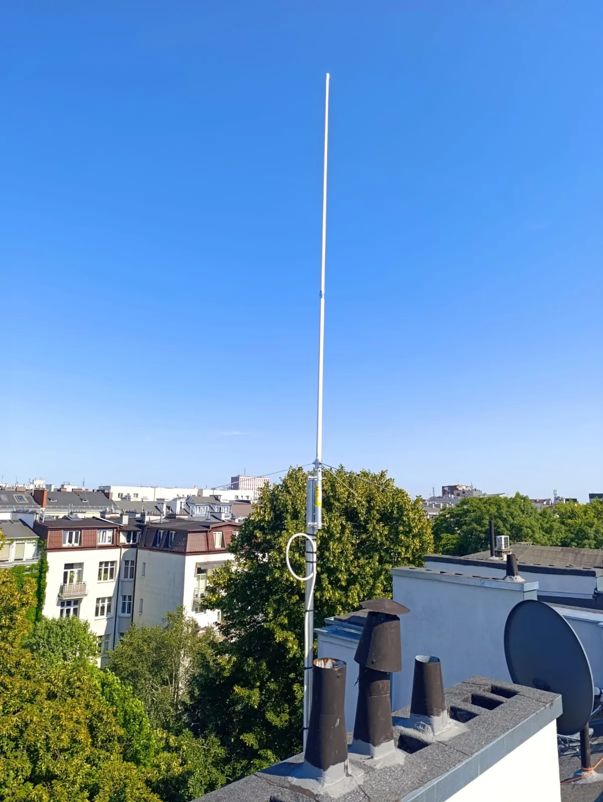
My QTH is Stary Mokotów (locator KO02ME). On the chimney of the tenement there’s a mast with a Diamond X-200N, a dual-band vertical for 2 m and 70 cm, and 28 metres of HyperFlex 10 cable carries the signal to the Icom IC-9700.

The SR7KI repeater is mounted on the RTCN Święty Krzyż tower, on the summit of Łysa Góra in the Świętokrzyskie Mountains. In a straight line it’s 149.8 km, bearing 179°, almost due south. The repeater antenna is 120 m above ground, and the mountain itself is 594 m a.s.l.

It worked: from my QTH in Stary Mokotów I can access SR7KI and make QSOs through it. And since SR7KI is permanently linked into the FM-LINK network, my voice carries on from Łysa Góra to repeaters from Suwalszczyzna to the Beskid Sądecki.

“From Stary Mokotów via SR7KI on Łysa Góra. 149.8 km, an IC-9700 and an antenna on a tenement chimney.”— Filip SQ5CBA, September 2026
A white Diamond X-200N vertical antenna on a mast above the tenement’s chimneys, with the rooftops of Mokotów, treetops and a cloudless sky in the background Diamond X-200N · Stary Mokotów · photo: SQ5CBA
Icom IC-9700 — VHF/UHF transceiver with touchscreen and spectrum scope 75 W
The radio for this QSO

Icom IC-9700

A base station for 2 m, 70 cm and 23 cm, built as an SDR. On 70 cm it delivers up to 75 W, and after 28 metres of cable about 43 W reaches the antenna. SR7KI requires narrow FM: on the IC-9700, in FM mode simply select filter FIL2 or FIL3 and the radio will automatically transmit with narrow deviation. More about the radio on the My equipment page.

2 m / 70 cm / 23 cmup to 75 W on 70 cmFM · FM-N · D-STARSDR
Map

149.8 kilometres due south

The gold line is the path of the waves from the roof in Mokotów to the tower on Łysa Góra. The dashed circles are the radio horizons: my antenna’s, 25 km, and SR7KI’s, about 100 km. Between them there’s a red section that’s out of sight from both my roof and the tower.

Route map: from Stary Mokotów to the SR7KI repeater on Łysa Góra, 149.8 km Dark map background from Warsaw to the Świętokrzyskie Mountains. A gold dashed line runs almost exactly north–south, from Mokotów to the RTCN Święty Krzyż tower. The small dashed circle around Warsaw is the radio horizon of SQ5CBA’s antenna, 25 km; the large circle around Łysa Góra is SR7KI’s horizon, about 100 km. The red section of the path between the 25th and 50th kilometre has no line of sight. SR7KI horizonapprox. 100 km SQ5CBA horizon25 km 75 km100 km125 km 25 km with noline of sightfrom 25 to 50 km Kawęczyn · SR5W SR7KI Łysa Góra · 438.725 MHz SQ5CBA Stary Mokotów · KO02ME N 25 km © OpenStreetMap
Map background © OpenStreetMap contributors · horizons computed from the EU-DEM terrain profile for a standard atmosphere (k = 4/3); the circles show their extent towards the path, in other directions the terrain gives different values.
Path profile

Beyond the horizon, and yet you can hear it

This is what the terrain between Mokotów and Łysa Góra looks like in cross-section, with the Earth’s curvature. The straight line between the antennas goes below ground. The wave still gets through thanks to diffraction at the horizon.

Terrain cross-section between Stary Mokotów and SR7KI on Łysa Góra Terrain profile over 149.8 km with Earth’s curvature added. The straight line between the SQ5CBA antenna (about 25 m above the rooftops of Mokotów) and the SR7KI antenna (120 m above the summit of Łysa Góra) passes below the ground surface. Two rays tangent to the horizon, from Warsaw and from Łysa Góra, meet above the terrain about 40 km from Mokotów: there the wave bends and goes beyond the horizon. 01002003004005006007008000 km25 km50 km75 km100 km125 km m a.s.l. 149.8 25 km without line of sight wave diffraction · approx. 40 km sea level + Earth’s curvature: 330 m bulge straight line between antennas, below ground SQ5CBA · X-200N Stary Mokotów, approx. 117 m + 25 m SR7KI · antenna 120 m above ground Łysa Góra, 593 m a.s.l. MokotówPiasecznonear GrójecBiałobrzeginear RadomStarachowiceŁysa Góra

← move the chart sideways →

Terrain from the EU-DEM model (OpenTopoData, point every 500 m) with Earth’s curvature for k = 4/3 · dashed line below the terrain = terrain without curvature · blue dotted = sea level with curvature · light dashed = rays tangent to the horizon from both antennas · light polyline = wave path after diffraction · vertical scale exaggerated by approx. 60× · height of the SQ5CBA antenna estimated
Earth’s curvature

330 m bulge

Halfway along the path the Earth bulges by about 330 m above the chord connecting the two ends, already with the correction for the bending of waves in the atmosphere. That’s more than the height of Varso Tower (310 m).

horizon

25 km in shadow

From my roof the radio horizon ends after 25 km, beyond Piaseczno. The antenna on Łysa Góra can see towards Warsaw as far as the Warka area, at 100 km. Between those points there is no direct path for the wave.

diffraction

Diffraction about 29 dB

The straight line between the antennas runs below the surface from kilometre 9 to 94, at worst 113 m underground. A 70‑centimetre wave, however, bends at the edge of the horizon, a bit like water behind a breakwater. By the Deygout method this costs about 29 dB on top of 128.8 dB free-space loss.

Link budget, i.e. where the margin comes from

Estimate for a standard atmosphere. SR7KI data from repeater databases; I assumed 3 dB loss for the cable on the tower.

Mokotów → Łysa GóraŁysa Góra → Mokotów
Transmitter power75 W · 48.8 dBm10 W · 40.0 dBm
Transmitter‑side cable−2.4 dB−3 dB
Transmit antenna+8 dBi (X-200N)+9 dBi
Free space, 149.8 km−128.7 dB−128.8 dB
Diffraction beyond the horizonapprox. −29 dBapprox. −29 dB
Receiver‑side antenna and cable+9 − 3 dB+8 − 2.4 dB
Signal at receiver inputapprox. −97 dBmapprox. −106 dBm
FM receiver sensitivity (12 dB SINAD)approx. −120 dBm−122 dBm (IC-9700)
Marginapprox. 23 dBapprox. 16 dB

The weaker link is the return path, because the repeater has only 10 W. That’s why, at the edge of coverage, the receiving antenna matters more than transmitter power. A margin of a dozen or so decibels isn’t much: when the atmosphere bends the waves less, the signal drops by a few decibels, and with an evening temperature inversion it can be markedly better.

Fun fact

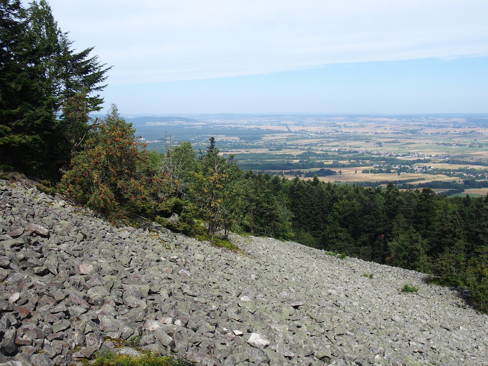
From Łysa Góra you can see Warsaw

It’s not just radio that makes the same journey. From the stone run below the summit the capital’s night lights have been photographed, and on the other side of the horizon, from the same spot, you can see the Tatra Mountains.

A wide panorama from the stone run on Łysa Góra looking north: in the foreground a dark fir forest, beyond a patchwork of fields and villages all the way to a hazy horizon
View from the stone run to the north · photo by ŁukaszWu, CC BY 3.0 · I determined the direction to Warsaw (azimuth 358.9°) from the annotated version of the panorama, matching the positions of eight places

28 May 2023, just after midnight

Łukasz Wawrzyszko and Paweł Kłak pointed telephoto lenses from the terrace on the stone run towards the capital. On the camera screens appeared the lights of Varso Tower and the Palace of Culture, and the tops of the ten tallest skyscrapers, 152–153 km from Łysa Góra. The furthest object photographed was the Kawęczyn Heat Plant chimney, 156.6 km — the same one that carries the antenna of Warsaw’s Wanda, SR5W.

In normal conditions Warsaw should be hidden below the horizon. That night a temperature inversion helped: near the ground cold air lay trapped, bending light rays more than usual.

Seen from the stone run, my roof lies almost exactly in line with the Palace of Culture. The bearing differs by 0.03°, about 90 m sideways at 150 km. Except that Mokotów is 3 km closer and much lower, below the horizon. Description of the observation with photos: Warszawa ze Świętego Krzyża.

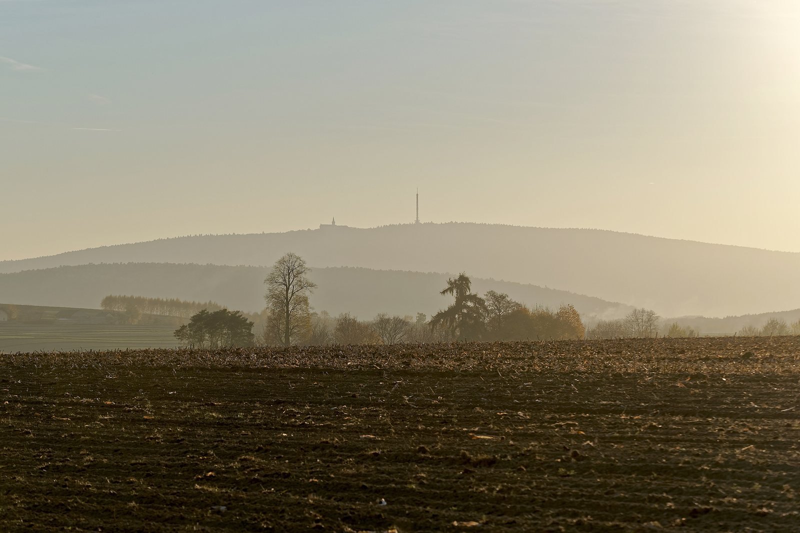
A misty view of the Łysa Góra range with the tower on the summit; in the foreground a ploughed field and solitary trees in golden light Fog below Łysa Góra · photo: Jakub Hałun, CC BY-SA 4.0
light 0.13 → 0.44

To see Warsaw

The refraction coefficient says how strongly the atmosphere bends a ray. For light it is usually about 0.13. The Varso spire peeks above the horizon at a coefficient of at least 0.3, and the lowest building photographed, Centrum LIM, required 0.44: three times the usual.

radio 0.25 → 0.56

For Łysa Góra to see Mokotów

Radio waves have it easier: in a standard atmosphere the coefficient is 0.25, hence k = 4/3. A clear line of sight to my antenna would only appear at 0.56. Diffraction does the rest: light doesn’t reach beyond the horizon, a 70‑centimetre wave does.

about 200 km

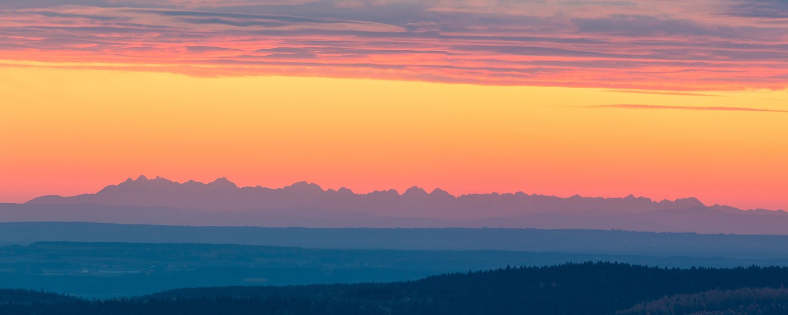
The other way you can see far as well. From Łysa Góra to Gerlach and Rysy is about 200 km, and in clear air the Tatras stand on the horizon like a paper cut‑out. The photo was taken by Paweł Kłak, who two years later also photographed Warsaw from here.

The Tatras from Święty Krzyż, 7.11.2021 · photo: Paweł Kłak, CC BY-SA 4.0
Timeline

Łysa Góra and Warsaw, one line

Warsaw was first “heard” on Łysa Góra almost seventy years ago.

1957

Television from Warsaw on the summit

Edward Roczniak, a member of the League of Friends of Soldiers, won a TV set and took it from Kielce to Święty Krzyż to try to receive the programme from Warsaw. The attempt succeeded, and the set remained in the care of the monastery for further tests.

1959

Relay station at the monastery

On 15 January a low‑power relay station started up on the monastery building. For the power line from Huta Nowa the monastery contributed 32,000 PLN.

1966built from 1962

The tower in the national park

The Ministry of Forestry was against it; the decision of Prime Minister Józef Cyrankiewicz proved decisive. Preparing the foundations in the rocky ground took over a year. The reinforced‑concrete shaft (126.5 m) was erected on 22 October 1964, with a 39‑metre steel section on top. Installation of the Tesla equipment was completed on 17 February 1966. Today the tower is 157 m tall and its signal reaches approx. 150 km.

2016

SR7KI on the FM-LINK network

On 23 November the repeater from Łysa Góra joined the nationwide FM-LINK network, thanks to the work of, among others, Janek SQ7LQJ, Marcin SQ7BCE and Wojtek SQ7PSQ.

2023

Warsaw in a photo

On 22 May Paweł Kłak first captured from the boulder field the light of the Varso spire, and on 28 May together with Łukasz Wawrzyszko the Kawęczyn chimney from 156.6 km. According to the authors this is the farthest point from which a view of Warsaw has been documented.

2026

Mokotów on SR7KI

From the roof of a tenement in Old Mokotów I can access the repeater on Łysa Góra. 149.8 km, 25 of them beyond the horizon.

Repeater

SR7KI on the holy mountain

An analogue FM repeater on 70 cm, permanently linked to the nationwide FM-LINK network. It uses narrow deviation and opens with an 88.5 Hz access tone.

What we know about SR7KI

  • Frequencies: output 438.725 MHz, input 431.125 MHz, offset −7.6 MHz.
  • Access: CTCSS tone 88.5 Hz. The repeater transmits the same tone, so you can enable TSQL on receive.
  • Narrow FM: deviation ±2.5 kHz, labelled in radios as NFM, FM-N or “half deviation”. If you transmit wide FM, you’ll be heard across the whole network with distortion.
  • FM-LINK network: 18 UHF repeaters from Jeleniewo near Suwałki to Przehyba, with the Warsaw‑area input SR5WP on the chimney in Moszna-Parcela. If you speak through one, you’ll be heard on all of them.
  • Equipment: Motorola MTR2000, 10 W, antenna 120 m above ground (fm-link.pl gives 100 m).
  • Maintainers: SP8SIW according to mapy73.pl; fm-link.pl lists SP7UDB, SQ7BCE and SP8SIW.
  • UKE (the Polish Office of Electronic Communications) licence: category 5, issued to the Polish Amateur Radio Union (PZK), valid until 31 January 2027.
Heard
from Mokotów

Repeater card

SR7KI · Łysa Góra · KO00MU
Band
70 cm
Mode
Narrow FM (±2.5 kHz)
Output · you listen
438.725 MHz
Input · you transmit
431.125 MHz
Offset
−7.6 MHz
CTCSS
88.5 Hz (TX and RX)
Network
FM-LINK, since 23.11.2016
Power
10 W
Equipment
Motorola MTR2000
Antenna
120 m above ground
Ground elevation
593 m a.s.l.
Licence
until 31.01.2027

Sources: przemienniki.eu, mapy73.pl, fm-link.pl, UKE licence register (dane.gov.pl, 31.08.2026)

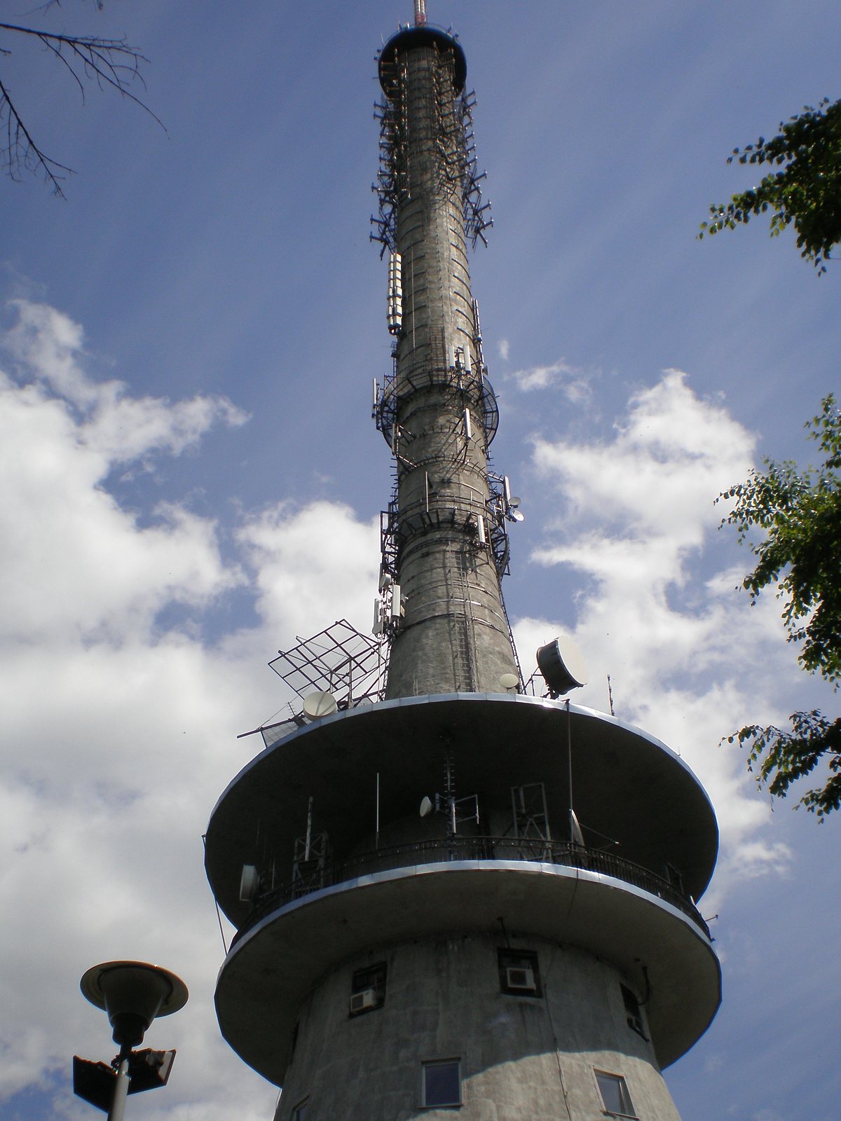
Upward view of the concrete RTCN Święty Krzyż tower: a wide circular platform with antennas and dishes, above a slender shaft with more antennas against a sky with clouds The tower up close · photo: SkyMaja, CC BY-SA 4.0

Five repeaters on one tower

Alongside TV and broadcast radio, the whole amateur radio family operates from the RTCN tower. All licences were issued to PZK.

CallsignModeOutput, MHzNotes
SR7VFM, 2 m145.625−600 kHz, CTCSS 88.5 Hz
SR7KINarrow FM, 70 cm438.725FM-LINK, the one on this page
SR7MKC4FM (Fusion)438.475licence until 2028
SR7DMKDMR439.4125listed as off‑air in databases
SR7UVKD-STAR439.125databases show differing status

Check digital repeaters before you travel: the databases are updated by users, and in the UKE register SR7UVK is listed with an output of 439.1625 MHz. Full list with map: repeaters in Poland.

Set up your radio

A minute’s work and you’re on SR7KI

Do you live within range of Łysa Góra or are you driving through Świętokrzyskie? Enter these settings into your 70 cm radio or load the ready‑made channel into CHIRP. Don’t forget narrow FM.

narrow FM 70 cm, deviation ±2.5 kHz

Receive (RX)
438.725 MHz
Transmit (TX)
431.125 MHz
Offset
−7.6 MHz
CTCSS tone (TX)
88.5 Hz
Mode
FM-N / NFM
Channel name
SR7KI

You’ll find narrow FM in the menu as NFM, FM-N, Narrow or ‘half deviation’. On the IC-9700, in FM mode, select filter FIL2 or FIL3. Enable an 88.5 Hz tone on transmit (Tone). The repeater transmits it as well, so TSQL will mute other repeaters on 438.725 MHz, e.g. SR6MA from Ślęża.

Download a CHIRP channel (CSV)
1

Listen

Set 438.725 MHz and listen. Via FM-LINK you can hear stations from all over Poland, so before you call, wait for a break between overs.

2

Quick check

A PTT press shorter than a second opens only SR7KI, not the rest of the network: the repeater will hold the carrier for approx. 3 s, without an end‑of‑over tone. One check is enough, because the third short press in a row closes the repeater.

3

Call

Press PTT, wait a second and only then speak: after a second of carrier with tone the whole network opens. Keep it concise and leave breaks; mobile stations have priority. More in the 2 m / 70 cm guide and in programming the radio.

The area

Łysa Góra, holy and devilish

The summit that carries SR7KI’s antenna has a longer history than any antenna.

height594 m

Second-highest summit of the Świętokrzyskie Mountains

Łysa Góra, formerly Łysiec, is second only to Łysica in the Łysogóry range. It is built of Cambrian quartzitic sandstones and shales, and its slopes are covered by the Puszcza Jodłowa.

legendsabbath

Witches’ mountain

In folk belief, witches would gather for night sabbaths on bare, hard‑to‑reach summits. The most popular such place in Poland was probably Łysa Góra itself.

9th–10th century1.5 km

Ritual rampart

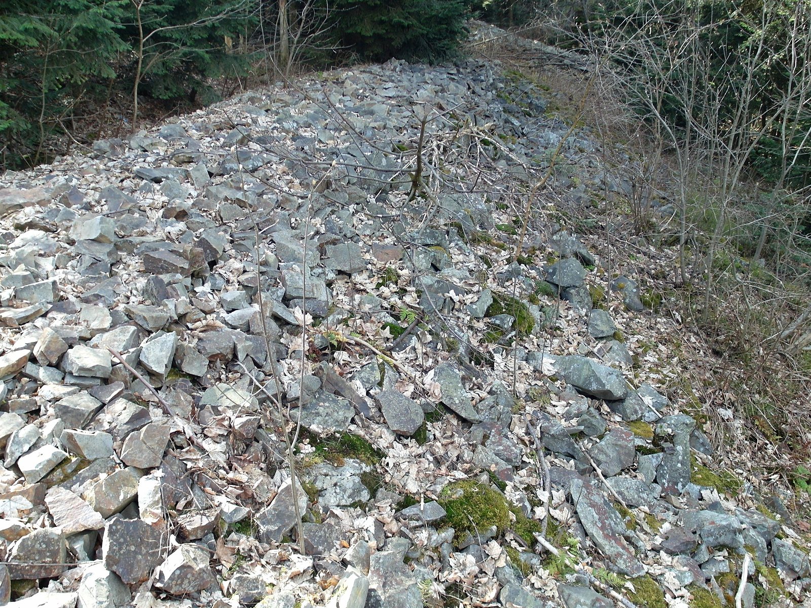
The summit is encircled by a stone rampart forming two horseshoes, up to 2 m high, made of approx. 32,000 m³ of quartzite. It is a trace of a pre‑Christian Slavic cult site. Construction was halted after the adoption of Christianity.

Pleistocenegołoborze

A mountain without forest

The boulder fields on the slopes formed when frost shattered the quartzite during the ice ages. Gołoborze means a ‘bare’ place, without the coniferous forest. The largest, Gołoborze Kobendzy, lies on the north slope, the one facing Warsaw.

since the 14th centuryŚwięty Krzyż

Relics and the province’s name

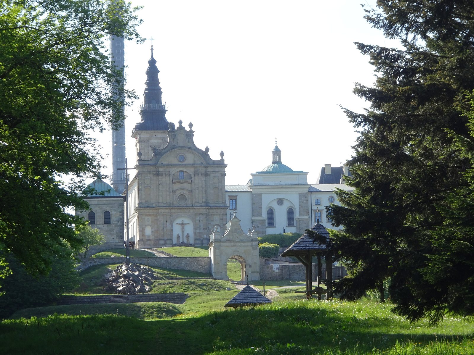
According to legend, the Benedictine abbey was founded by Bolesław Chrobry in 1006. From the relics of the True Cross the mountain, the Świętokrzyskie Mountains and the entire province took their name. After the dissolution of the order a prison was set up within the walls, regarded in the interwar Second Polish Republic as the harshest in Poland.

438.725 MHz305 km

Sister on Ślęża

On the same frequency, SR6MA on Ślęża transmits — the other ‘holy mountain’ with a stone ritual rampart. It lies almost exactly on the same parallel, 305 km to the west. According to przemienniki.eu it opens with a different access tone, 94.8 Hz.

Sources: Wikipedia (Łysa Góra, RTCN Święty Krzyż, Łysogóry, Gołoborze, Sabbath) · dalekiehoryzonty.pl · fm-link.pl (about the network, etiquette, SR7KI) · przemienniki.eu · mapy73.pl · UKE (the Polish Office of Electronic Communications) licence register · Icom IC-9700 manual · terrain profile: EU-DEM via OpenTopoData · map base: OpenStreetMap

Photos from Wikimedia Commons: tower — Kroton (CC BY 3.0) · tower close‑up — SkyMaja (CC BY-SA 4.0) · rapeseed and mist — Jakub Hałun (CC BY-SA 4.0) · panorama — ŁukaszWu (CC BY 3.0) · Tatra Mountains — Paweł Kłak (CC BY-SA 4.0) · stone run — Agnieszka Kwiecień, Nova (CC BY-SA 4.0) · rampart — Mathiasrex (CC BY-SA 4.0) · terrace — Jolanta Dyr (CC BY-SA 3.0) · monastery — Bartosz Nadolski (CC0) · X-200N antenna and IC-9700 — SQ5CBA

Filip SQ5CBA — portrait SQ5CBA
QSO author

Filip SQ5CBA

Radio amateur from Warsaw, QTH Stary Mokotów (KO02ME). Operates on 2 m, 70 cm and 23 cm, in FM, C4FM and D-STAR, from a base station and a handheld. This time from home: IC-9700, an antenna on the chimney and a repeater 150 km away, beyond the horizon. The station equipment is described on the My equipment page, and all contacts are shown on the My contacts map.

70 cm · narrow FMSR7KI · FM-LINKWarsaw · KO02MEtext: SQ5CBA
Read more

More repeaters and coverage

A map of all active 2 m and 70 cm repeaters in Poland, a contact from a field near Łęczyca via SR7KU, and a calculator that will work out your antenna’s radio horizon.