

Home  /  News  /  QSO via SR7KU Kutno

News · 12 September 2026

From a field near Łęczyca to Kutno

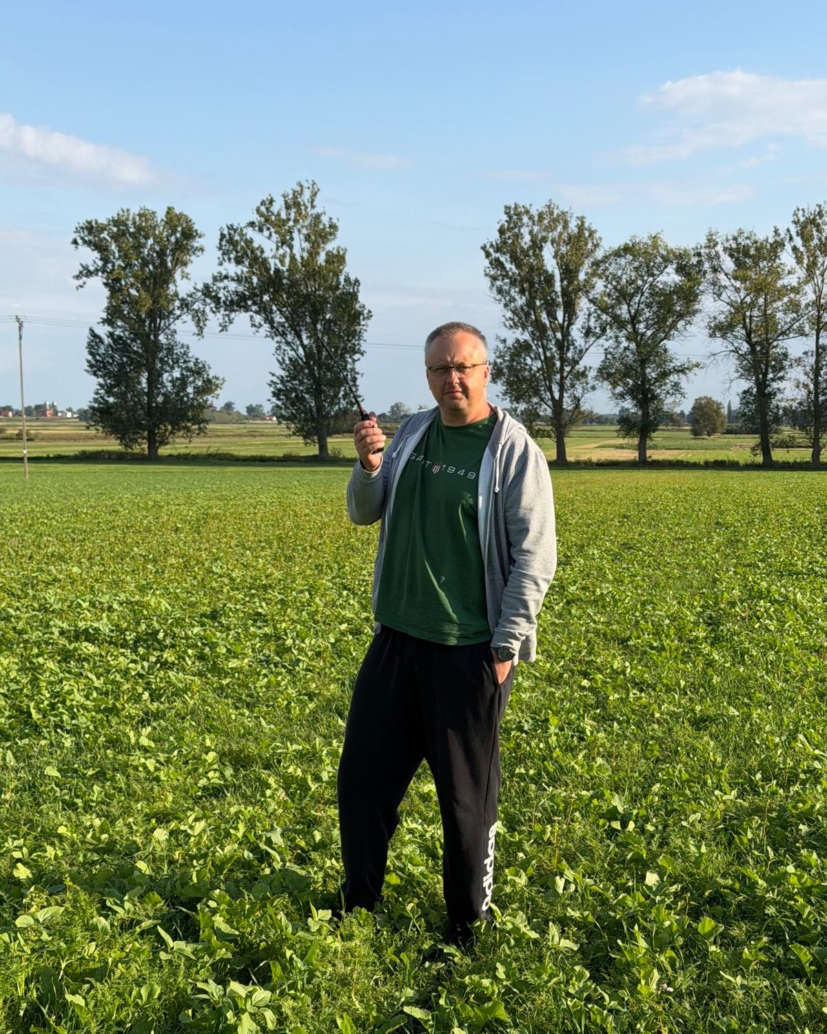
A green field near Topola Szlachecka, an Icom ID-52E PLUS in my hand and the SR7KU repeater in Kutno. In a straight line it’s 18.7 km, and the radio horizon for this pair of antennas comes out at 19.3 km. On paper I had a few hundred metres in hand; on the air it was enough.

Filip SQ5CBA — portrait
Filip SQ5CBAcontact and photos · Łęczyca municipality
Icom ID-52E PLUS
Icom ID-52E PLUSradio used for this QSO · 5 W
70 cm · FM SR7KU Kutno 18.7 km Icom ID-52E PLUS
12.09.2026 · Topola Szlachecka · SQ5CBA
18.7km in a straight line
from the field to the repeater
19.3km radio horizon
handheld + 12 m antenna
438.925MHz, SR7KU output
you listen here
82.5Hz, CTCSS tone
opens the input
QSO

A field, some poplars and one repeater

No mast, no amplifier and no hill. A handheld, an open field and the Kutno repeater on 438.925 MHz.

12 September, near Łęczyca

Topola Szlachecka is a village in the Łęczyca municipality, in Łęczyca county. Flat as a table all around: fields, rows of poplars along the roads and a wide sky. For 70 cm waves it’s a good spot, as there are no blocks of flats or forests between the antenna and the horizon.

From there, before sunset, I made a contact from the handheld Icom ID-52E PLUS via the repeater SR7KU in Kutno. The repeater is 18.7 km away, to the north-east, bearing 36°. Along the way only fields, villages and roads. The highest point of the profile is just a couple of dozen metres above the lowest.

This is what ‘handheld’ operation at the edge of range looks like. The antenna height is the height of your arm, and the number of kilometres depends on how much the Earth’s curvature will allow. Below: a map, a terrain profile and a bit of physics to explain why it worked.
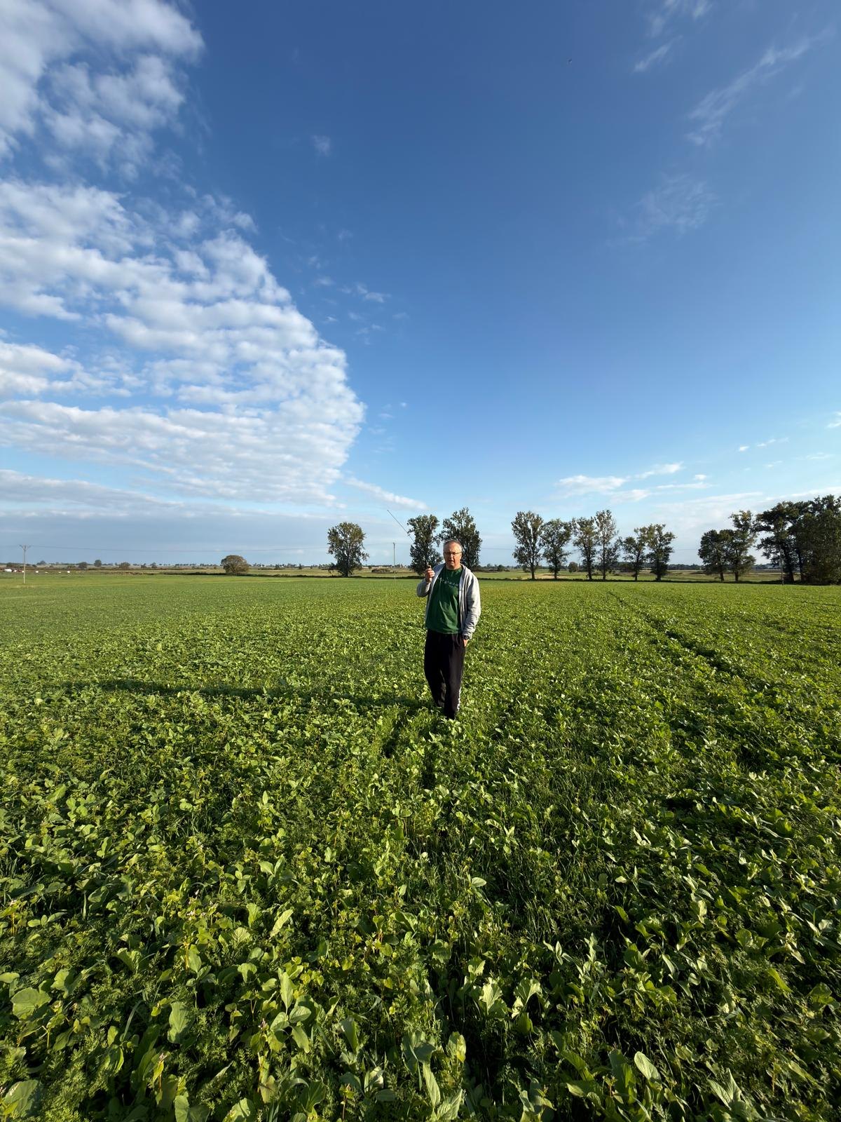
“A contact from a field near Łęczyca via SR7KU in Kutno. Icom ID-52E PLUS in hand, 18.7 km in a straight line.”— Filip SQ5CBA, 12 September 2026
Wide shot: Filip SQ5CBA holding a radio stands in the middle of a vast green field, above him a blue sky with bands of cloud, a row of trees on the horizon Horizon in a proglacial valley · 12.09.2026
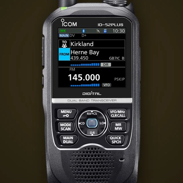
Icom ID-52E PLUS — handheld transceiver with a colour screen 5 W
The radio for this QSO

Icom ID-52E PLUS

A dual-band handheld for 2 m and 70 cm with digital D-STAR and analogue FM, with power adjustable from 0.1 to 5 W. On SR7KU it worked in plain FM with an 82.5 Hz tone, and the colour spectrum scope shows what’s happening around the repeater frequency. More about this radio on the My gear page.

2 m / 70 cmFM + D-STAR0.1–5 WIPX7
Map

18.7 kilometres to the north-east

The golden line is the path of the waves from the field near Topola Szlachecka to the repeater in Kutno. The dashed arc is SR7KU’s radio horizon for a handheld: 19.3 km. Topola sits just in front of it.

Route map: from Topola Szlachecka to the SR7KU repeater in Kutno, 18.7 km A dark basemap of the Łęczyca–Kutno area. A golden dashed line links the field near Topola Szlachecka with the SR7KU repeater in Kutno; the dashed arc is the 19.3 km radio horizon around the repeater. radio horizon · 19.3 km 18.7 km · bearing 36° SR7KU Kutno · 438.925 MHz SQ5CBA field · Topola Szlachecka N 5 km © OpenStreetMap
Map base © OpenStreetMap contributors · SR7KU position by locator JO92QF. Repeater databases give the centre of the grid square, so the actual mast may be up to about 3 km away.
Path profile

Flat, yet still uphill

This is what the ground between Topola and Kutno looks like in cross-section. It may look like a plain, but over 18.7 km the Earth has time to bulge, and a 70 cm wave needs far more clearance than a thin line of sight.

Terrain cross-section between Topola Szlachecka and SR7KU in Kutno Chart: terrain with Earth’s curvature over 18.7 km, line of sight from a radio 1.5 m above ground to a repeater antenna 12 m above ground and the first Fresnel zone with a radius up to 57 m, whose lower half goes below ground. 801001201401601800 km5 km10 km15 km m a.s.l. 18.7 bulge 3.7 km from Topola approx. 125 m a.s.l. + curvature line of sight 1st Fresnel zone · 57 m radius at mid-path SQ5CBA · ID-52E PLUS, 1.5 m Topola Szlachecka, approx. 113 m SR7KU · 12 m antenna Kutno
Terrain from the EU-DEM model (OpenTopoData, point every approx. 230 m) with Earth’s curvature added for k = 4/3 · dashed line under the terrain = terrain without curvature · vertical scale exaggerated by approx. 47× · path endpoints approximate
Earth’s curvature

a 5-metre bulge

At mid-path the Earth’s sphere rises about 5 m above the chord joining the two ends. That already includes the bending of waves in the atmosphere (k = 4/3). On the plain that’s more than many a hill.

Fresnel zone

57 metres instead of a line

A wave doesn’t travel in a thin line. Most of the energy is carried in the spindle-shaped region around it, the first Fresnel zone. At 438.9 MHz, halfway along this path, its radius is about 57 m, and the antennas were 1.5 and 12 m above ground. So the lower half of the zone was in the ground.

link budget

About 50 dB to spare

With the full 5 W from the ID-52E PLUS and an X-200 antenna (8 dBi), about −69 dBm would reach the repeater input in free space. A sensitive FM receiver hears signals around −120 dBm, so there’s a generous margin for the wave to bend over the terrain.

Repeater

SR7KU, the Kutno seventy-centimetre repeater

An analogue FM repeater on the 70 cm band. No sign in the databases of internet links or digital modes: plain FM and an antenna 12 metres above the plain.

What we know about SR7KU

  • Frequencies: output 438.925 MHz, input 431.325 MHz. The −7.6 MHz offset is the 70 cm repeater standard in Poland.
  • Access: CTCSS tone 82.5 Hz on the input. Without the tone the repeater won’t respond to a carrier alone.
  • Power and antenna: 10 W into a Diamond X-200 antenna, a dual-band collinear (on 70 cm about 8 dBi), mounted 12 m above ground. The site is at about 118 m a.s.l.
  • Repeater keeper: SP7IIX of Kutno.
  • UKE licence: category 5 (unattended station), valid until 31 March 2031, power in the licence up to 15 W.
  • Neighbours: the nearest other repeater, SR7DVK, is about 35 km away, and the Łódź-area ones are over 50 km.

SR7KU has been in the community database przemienniki.eu since June 2024, and users report it as working. As of 12 September 2026 I can confirm that too, from a field near Łęczyca.

Working
12.09.2026

Repeater card

SR7KU · Kutno · JO92QF
Band
70 cm
Mode
FM (analogue)
Output · you listen
438.925 MHz
Input · you transmit
431.325 MHz
Offset
−7.6 MHz
CTCSS
82.5 Hz (on the input)
Power
10 W
Antenna
Diamond X-200, 12 m above ground level
Ground elevation
118 m a.s.l.
Keeper
SP7IIX
Licence
until 31.03.2031

Sources: przemienniki.eu, mapy73.pl, vhf.com.pl, UKE licence register (dane.gov.pl, 31.08.2026)

Set up your radio

One minute’s work and you’re on SR7KU

Will you be around Kutno, Łęczyca or on the A1 motorway? Enter these values into any 70 cm radio or load the ready-made channel into CHIRP.

FM 70 cm, any dual-band radio

Receive (RX)
438.925 MHz
Transmit (TX)
431.325 MHz
Offset
−7.6 MHz
CTCSS tone (TX)
82.5 Hz
Mode
FM
Channel name
SR7KU

Enable an 82.5 Hz tone on transmit (Tone or ENC), not on receive (TSQL). If the repeater doesn’t add the tone to its retransmission, a radio with TSQL will simply go silent.

Download the CHIRP channel (CSV)
1

Listen

Set 438.925 MHz and listen for a moment. If someone is talking, wait for a gap between overs.

2

Check you’re getting in

Briefly press PTT and give your callsign, e.g. “SQ5CBA, test via SR7KU”. If you hear the repeater’s carrier after releasing PTT, you’re getting in. A bare kerchunk without a callsign is bad practice.

3

Call

“SQ5CBA here, general call via SR7KU” and pause. From the field also say where you’re transmitting from, as that’s always of interest. More in the 2 m / 70 cm guide.

The area

Łęczyca Land from the perspective of radio waves

The route runs through a region where flatness is a feature of the geography, not a coincidence.

ice-marginal valley

Why so flat

Łęczyca lies on the Bzura, exactly where the Bzura valley opens into the Warsaw–Berlin ice-marginal valley, a wide depression carved by the meltwaters of the retreating ice sheet. Hence the plain: across the whole section between Topola and Kutno the terrain varies by around 20 metres.

one voivodeship

Topola and Kutno, once together

In 1975–1998 both Topola Szlachecka and Kutno belonged to the Płock Voivodeship. Today both places are in Łódź Voivodeship. Topola lies in Łęczyca County, while Kutno, the seat of Kutno County on the Ochna, has about 41,000 inhabitants.

1939

Battle of the Bzura

From 9 to 22 September 1939, the Battle of the Bzura, also called the Battle of Kutno, was fought in this area. It was the largest battle of the September Campaign: the “Poznań” and “Pomorze” armies struck the flank of the German 8th Army. The QSO on 12 September 2026 fell on the 87th anniversary of those events.

Sources: Wikipedia (Topola Szlachecka, Łęczyca, Kutno, Battle of the Bzura) · elevation profile: EU-DEM via OpenTopoData · map base: OpenStreetMap

Filip SQ5CBA — portrait SQ5CBA
Author of the QSO and photos

Filip SQ5CBA

A radio amateur from Warsaw, QTH Mokotów (KO02ME). Active on 2 m, 70 cm and 23 cm, in FM, C4FM and D-STAR, from the base station and handheld. This time with an Icom ID-52E PLUS in hand, in a field near Łęczyca, where the antenna had nothing but the horizon ahead. The station equipment is described on the My equipment page, and repeaters from across the country can be found on the repeater map.

70 cm · FMlocation: Topola SzlacheckaWarsaw · KO02MEtext and photos: SQ5CBA
Read more

More repeaters and coverage

A map of all active 2 m and 70 cm repeaters in Poland, Warsaw’s Wanda on the Kawęczyn chimney and a calculator that will work out your antenna’s radio horizon.